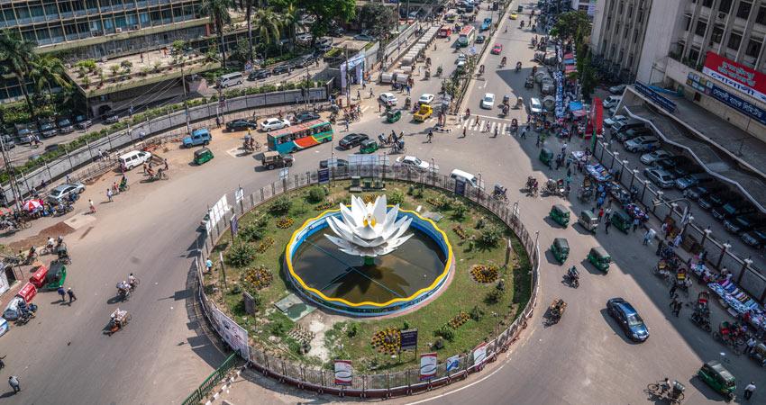
About Bangladesh
Everyone should know
Area: 147,510 sq km
It was renamed 'Bangladesh' in 1969: 1969
December 5th
State Name: Republic of Bangladesh
English name: The people's Republic of Bangladesh.
Victory: December 16, 1971
Independence and National Day: March 26
Victory Day: December 16
There were colonies: first to the United Kingdom
(1757-1947) and later to Pakistan
(1947–1971)
Independence: From Pakistan.
Membership of the United Nations: 17 of 1974
September (29th session)
✪Capital: Dhaka
Commercial capital: Chittagong
State language: Bengali (98%)
Majority community: Muslim (90.39%), Hindu
(*.54%), Buddhist (*.62%), Christian (*.31%) and others
(*.14%)
Method of Government: Parliamentary System of Government
The Legislative Assembly: The National Assembly
Local time: Greenwich standard time is *+ hours
Sending troops to UN peacekeeping missions: 2nd
✪Total tribes 48
Total seats in the National Assembly: 350 (elected)
300 seats and 50 reserved Mahila seats)
Parliamentary elections held: 11 times
Weather Station: *
Weather stations: 35
Everest Conquering Country: 67th
UNESCO Declared World Heritage: * (Sixty Domes)
Mosque, Paharpur Buddhist Vihara and Sundarbans)
Administrative Divisions: * (Last Mymensingh)
Districts: 64
City Corporation: 12 (12th Mymensingh City)
The Corporation)
Municipalities: 328
✪Upazila: 492
Police Stations: 650
Union: *,562
✪Villages: 87191
Bangladesh's position in the world in size: 94th
✪ Earthquake Observatory: *
Warning signs for river ports: *
Warning signs for sea ports: 11
Coastal districts: 19
Indian states bordering Bangladesh: *
West Bengal in India bordering Bangladesh
Districts: *
Position in the world in population: 8th
✪ Position within the continent of Asia in population: 5th
Position in South Asia in population: 3rd
Position in the Muslim world in population: 4th
Border countries: * (India, Myanmar)
✪ Census: * times
Number of sectors of the Liberation War: 11
Registered political parties: 41
✪ Earth-satellite centers: *
Number of identical rivers: 57
Rivers of international standard: * (Padma)
Government notes: * (Tk. *, Tk. * and Tk. *)
Bank notes: * (10)
About Bangladesh
Everyone should know
Area: 147,510 sq km
It was renamed 'Bangladesh' in 1969: 1969
December 5th
State Name: Republic of Bangladesh
English name: The people's Republic of Bangladesh.
Victory: December 16, 1971
Independence and National Day: March 26
Victory Day: December 16
There were colonies: first to the United Kingdom
(1757-1947) and later to Pakistan
(1947–1971)
Independence: From Pakistan.
Membership of the United Nations: 17 of 1974
September (29th session)
✪Capital: Dhaka
Commercial capital: Chittagong
State language: Bengali (98%)
Majority community: Muslim (90.39%), Hindu
(8.54%), Buddhist (0.62%), Christian (0.31%) and others
(0.14%)
Method of Government: Parliamentary System of Government
The Legislative Assembly: The National Assembly
Local time: Greenwich standard time is 6+ hours
Sending troops to UN peacekeeping missions: 2nd
✪Total tribes 48
Total seats in the National Assembly: 350 (elected)
300 seats and 50 reserved Mahila seats)
Parliamentary elections held: 11 times
Weather Station: 4
Weather stations: 35
Everest Conquering Country: 67th
UNESCO Declared World Heritage: 3 (Sixty Domes)
Mosque, Paharpur Buddhist Vihara and Sundarbans)
Administrative Divisions: 8 (Last Mymensingh)
Districts: 64
City Corporation: 12 (12th Mymensingh City)
The Corporation)
Municipalities: 328
✪Upazila: 492
Police Stations: 650
Union: 4,562
✪Villages: 87191
Bangladesh's position in the world in size: 94th
✪ Earthquake Observatory: 4
Warning signs for river ports: 4
Warning signs for sea ports: 11
Coastal districts: 19
Indian states bordering Bangladesh: 5
West Bengal in India bordering Bangladesh
Districts: 8
Position in the world in population: 8th
✪ Position within the continent of Asia in population: 5th
Position in South Asia in population: 3rd
Position in the Muslim world in population: 4th
Border countries: 2 (India, Myanmar)
✪ Census: 5 times
Number of sectors of the Liberation War: 11
Registered political parties: 41
✪ Earth-satellite centers: 4
Number of identical rivers: 57
Rivers of international standard: 1 (Padma)
Government notes: 3 (Tk. 1, Tk. 2 and Tk. 5)
Bank notes: 6 (10)


